|
|
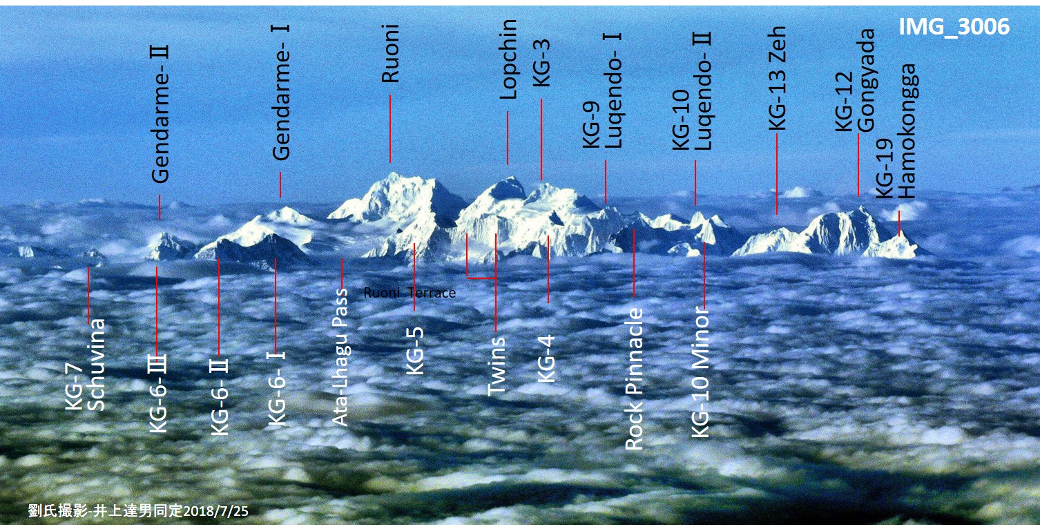
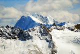
Ruoni 6882m Lopchin6805m KG-3 6726m Gongyada6482m
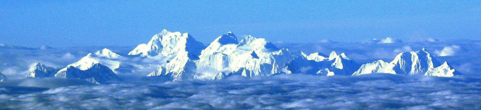
Aerial picture
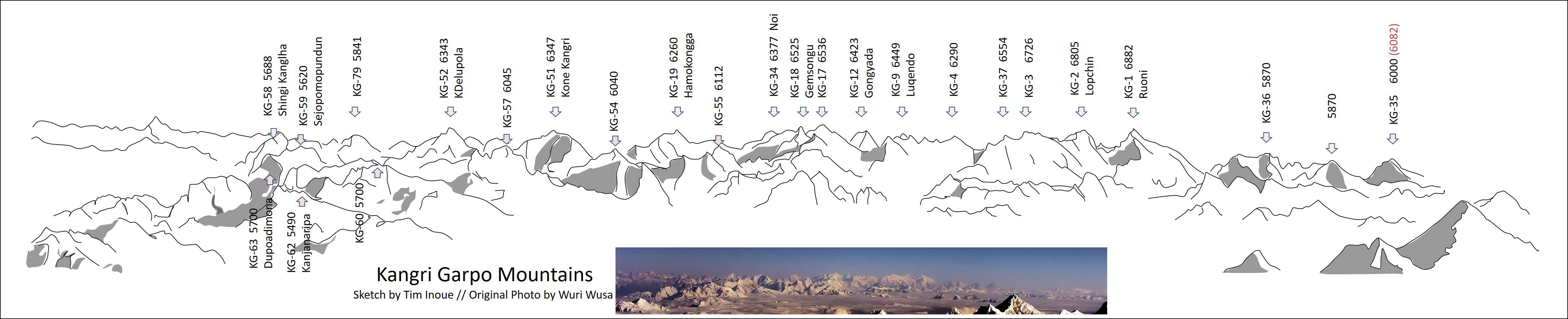
Panorama sketch : West side view of thewhole range
(click picture to enlarge)
|
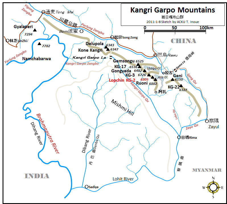
| 1.Overview: Kangri Garpo Mountains |
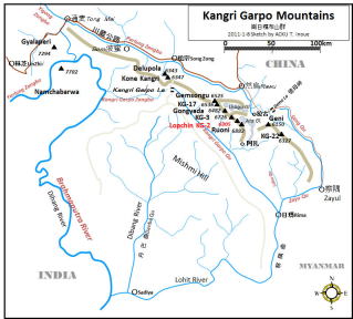
Map: Outline |
an identification report of 47 unclimbed peaks
A peak identification study of the Kangri Garpo and the Nyaiqentanglha
West mountains
|
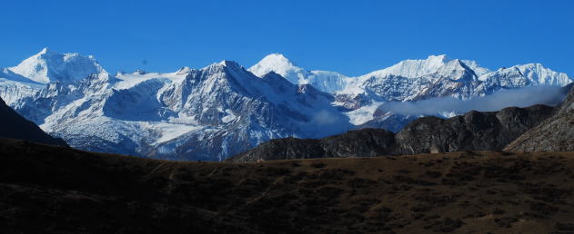
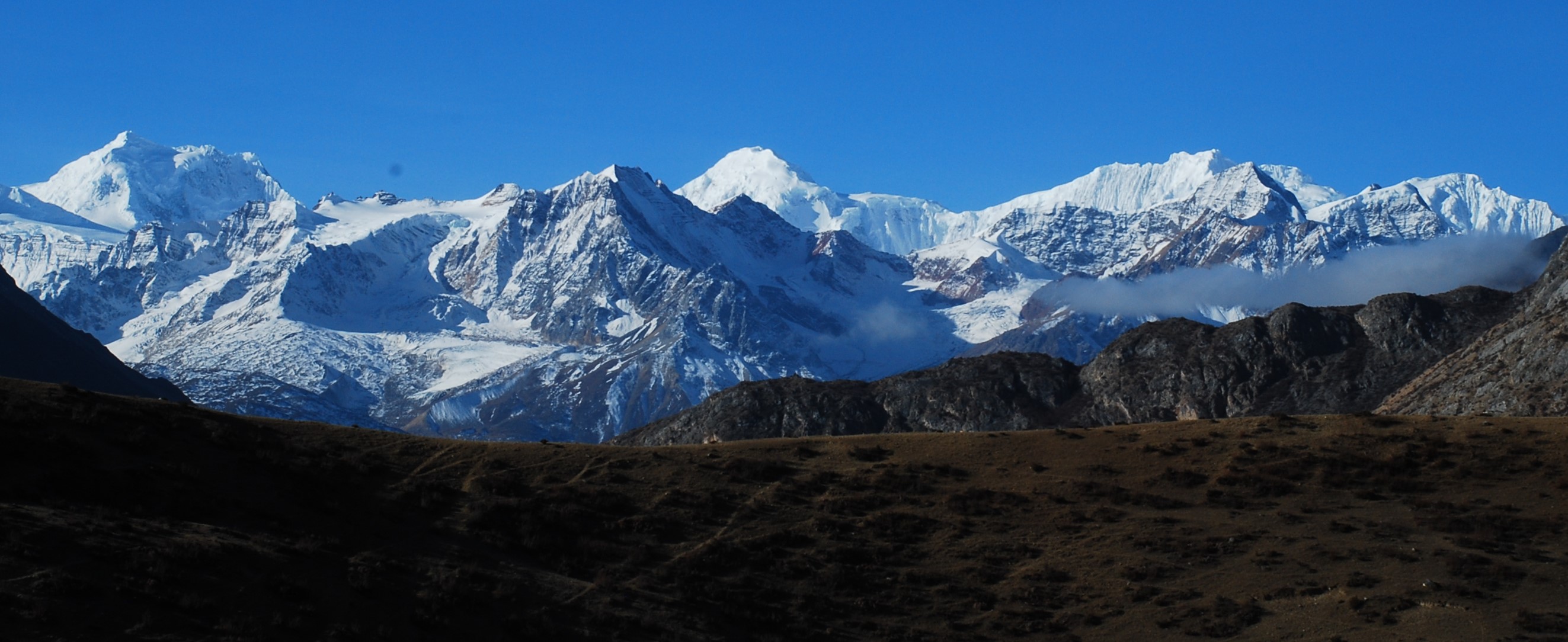
Ata Glacier 3-Sisters: Ruoni, Lopchin,KG-3 (from Dema La) |
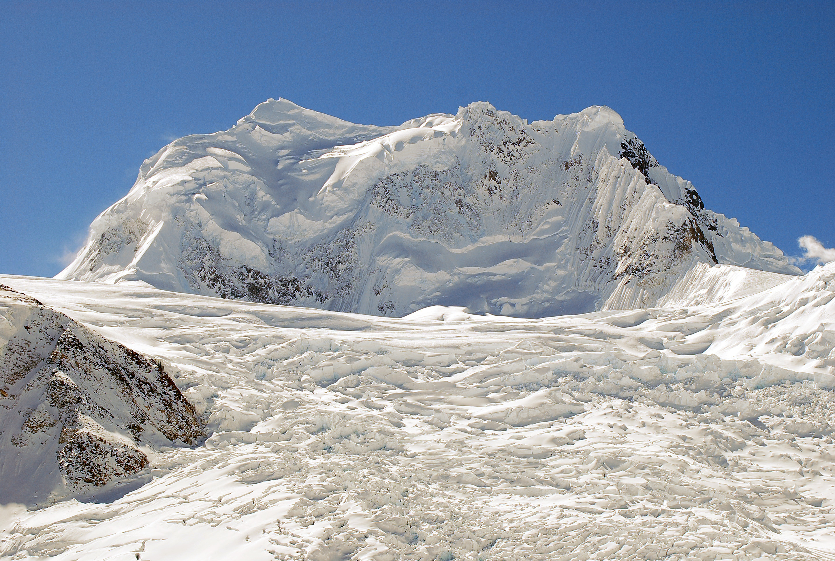
| 2 The first ascent of Lopchin Feng 6805m |
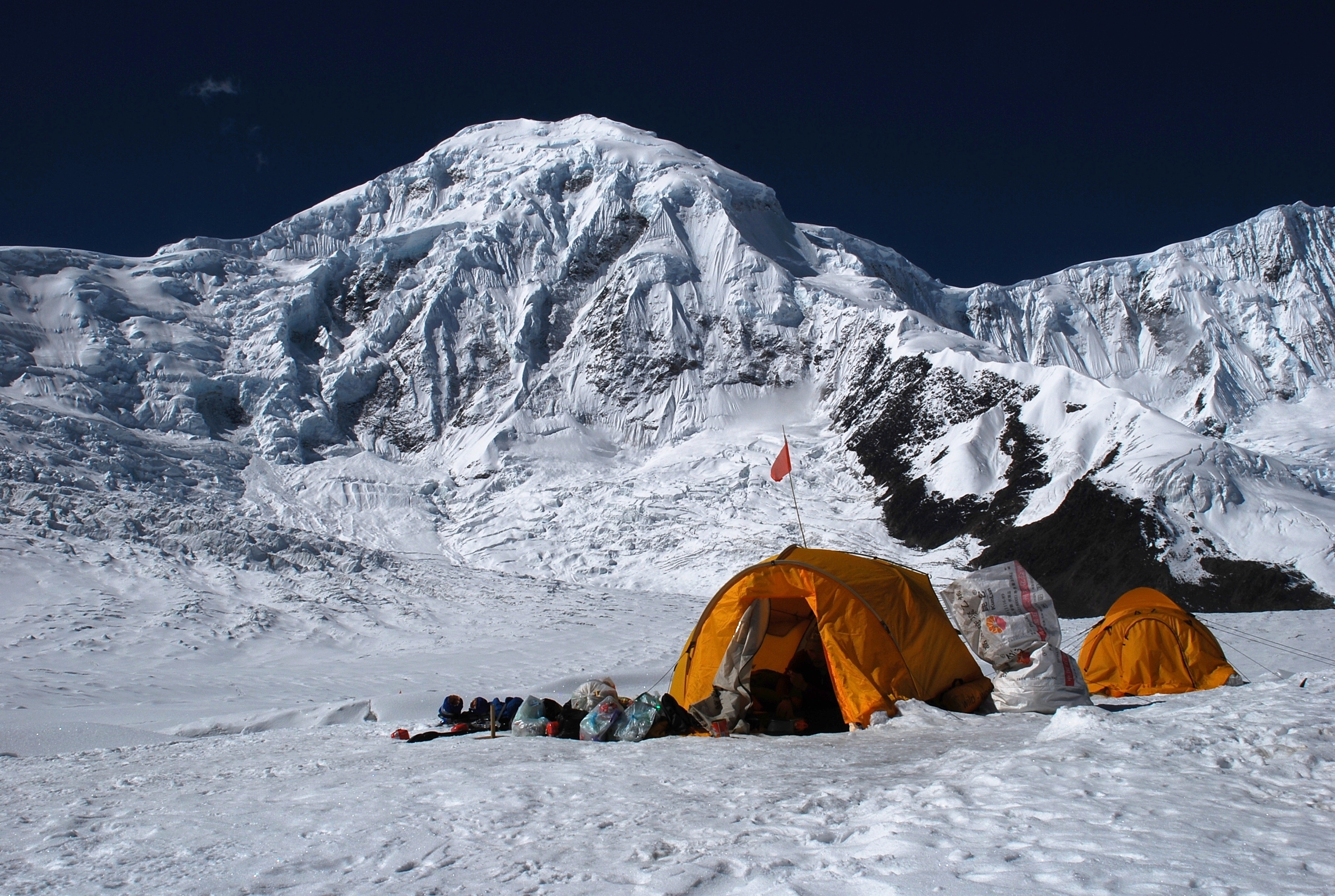
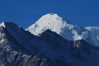 Lopchin 6805m Lopchin 6805m
|
|
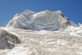
Ruoni Feng 6882m |
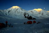
Sun-rise & Moon set |

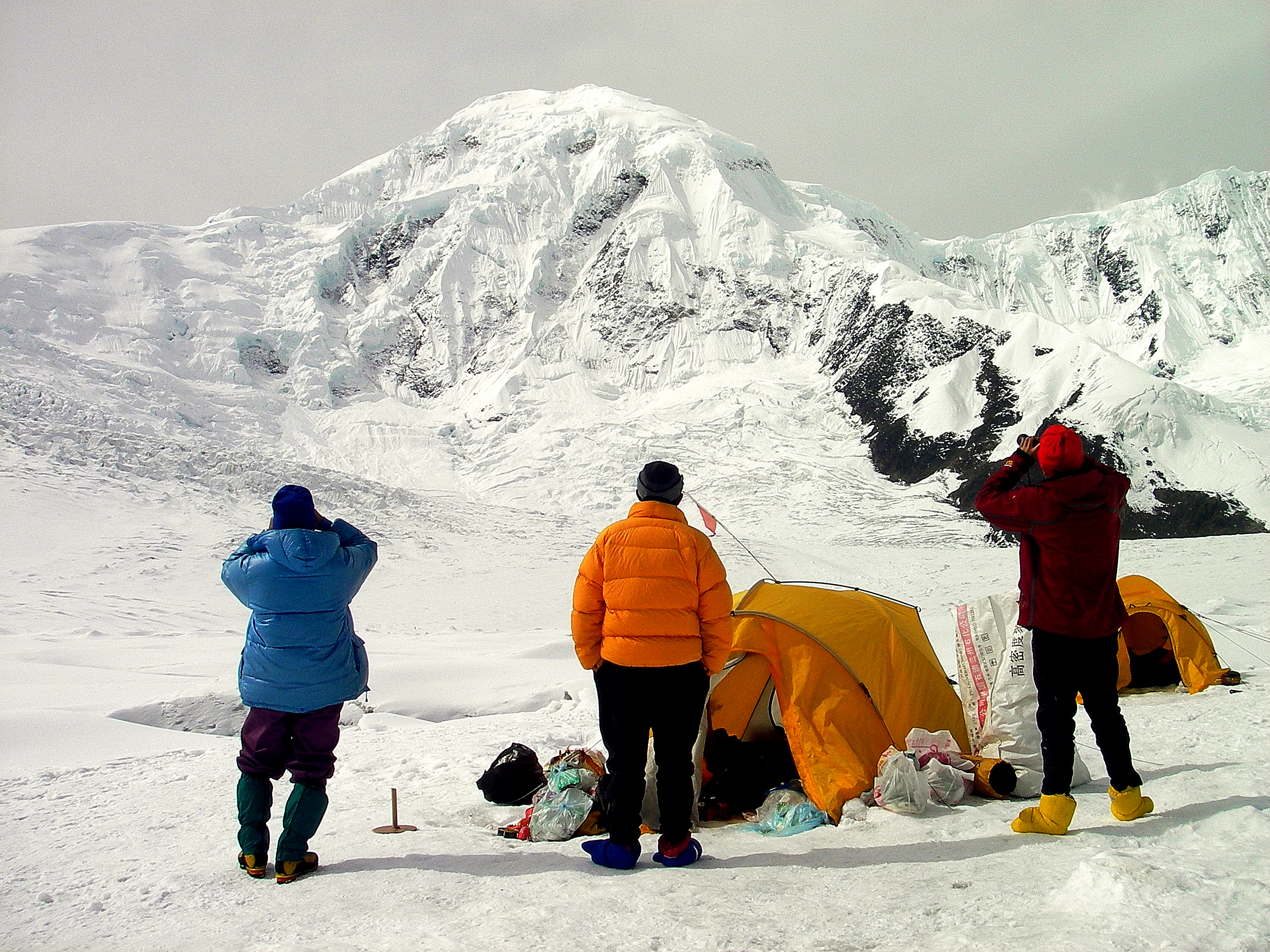
Lopchin from Camp-1 |

Watching attack at C1 |
Yuhe Kangri 6327m |
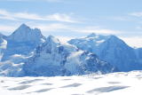
Shana & Ata Kangri |
| 3 Articles (English and Japanese) |
1) November 2007 Ata Glacier reconnaissance
Mr. Takeru Yamada had led the party to the Ata Glacier, Kangri Garpo Range.
He had found possible route to KG-2 (Lopchin Feng 6805m) instead of the
route to the top of Ruoni, which is the highest peak of Kangr Garpo Mountains.
2) Glacier_receding_of_the-Ata-Glacier
ACKU (The Alpine Club of Kobe University) sent expedition parties to the
Ata Glacier in 2002, 2003, 2007 qnd 2009. They had good opportunity to
survey the change of the glacier. The glacier was apparently shulinking
. The climate change of the region affected dramatic receding of the ice.
3)Detail study of Kangri Garpo Mountains
area-1.Konekangri-Delupola
area-2.Gemsongu-Genikutz
area-3.Lhagu_Glacier
area-4.Ata_Glacier
area-5.Gheni-P6327m
Pictures and Maps of the Kangri Garpo Mountains provide identification
of the peaks. Many persons who were visiting this range provided many informations
and pictures to identify peaks.
4) 未知の山群を探る(Peak identification: Japanese)
カンリガルポ山群東南部
カンリガルポ山群ラグー氷河周辺
カンリガルポ山群西部
山座同定の詳細 (ACKU News 37 38 39 掲載)
5) 初登頂 Lopchin Feng 6805m Presentation
報告会などで発表したPowerpoint presentation
6) 登頂記: 近藤隊員 2009年11月7日
7) 「兵庫人」---2010年発行、神戸新聞の記事から活躍した人を掲載
Profile of Members
10 Chinese and 7 Japanese
|
|